

DDrillv7Pro app for iPhone and iPad
Developer: Whichtoolface.com
First release : 14 Jul 2012
App size: 26.07 Mb
This is a Rig Floor Directional Drilling application for the iPad/iPhone/iTouch, which requires IOS12.4 operating system. This is not a well planning application, although one is able to project to targets from the actual survey data.
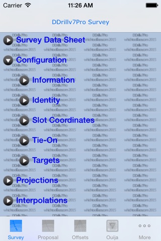
The package is divided into 6 sections. The Survey section deals with the actual survey, which one is drilling, the Proposal section obviously the proposed directional design, the Offsets section, for introducing close by surveys in order to generate close approach data, a Ouija Board section, Geodesy & Magnetic Calculations and a general Settings Section.
A combination of Tab and TreeView controls enables one to navigate through the app.
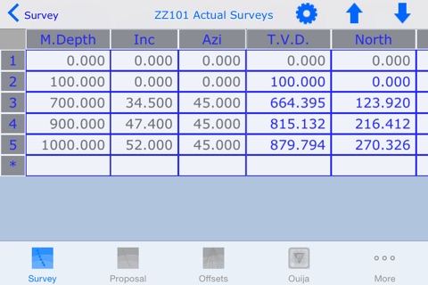
The app presents the survey data in a Datasheeet for viewing and editing. The distance off the line from the proposal can be shown in the Datasheet
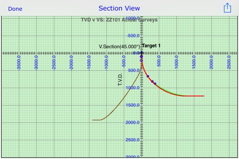
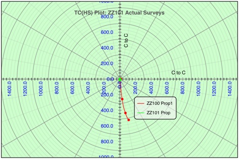
One is able to plot Section, Plan & 3D views of the survey, proposal, offsets, targets and projection data. Through the Proximity routines, one can plot Traveling Cylinder data. The app will generate reports(pdf, txt, ut), import files(app specific xml & txt, WinSurve SAY, the Baker Hughes csv, the Sclumberger xls/xlsx , the SDI & the DPA survey transfer files) and plots(png, pdf) to export, using wifi server & desktop browser, email and obviously iTunes.
By introducing targets, one can project to target centers or edges. Targets can be entered in local or grid coordinates.The target zones supported are a circle or a rectangle, the attitude of which can be altered, as well as polygon entry in 3D.
One can import data through wifi server & desktop browser and by opening an email xml or SAY file attachment, as well as beaming data between iOS devices.
Presently, to minimize data entry, there is a cef file for Landmarks Compass, which will generate a app specific xml to download to this app, hence one can import survey data from a major Directional Drilling survey package. However the app is able to import the Winsurve SAY file, the BHI csv, SLB xls and the SDI & the DPA survey transfer files.
Although this app is probably specific to the oilfield, river crossing calculations can also be performed.
The app includes a Geodetic to Map projection converter and a IGRF & WMM magnetic calculator, this information can then be imported into Slot Coordinate information and Anti-collision inputs.
The app has introduced ellipses of uncertainty, however unfortunately this work is incomplete at time of release and generated Separation Factors should not be used to steer through adjacencies. An extensive database of the Survey Tool Errors curtesy of Steve Grinrod Cosgrove Developments can be found in the Settings module.